Tips for Hiking the Wave at Coyote Buttes
COYOTE BUTTES NORTH
The Wave is a sandstone rock formation right along the Arizona-Utah border between Page, AZ and Kanab, UT. It has become very popular thanks to social media but very few people actually get to see it due to only twenty people per day getting permits, which happens through a lottery system. I entered the lottery in November for a March permit and was successful so this is our journey to this magical place.
THE BLM LOTTERY SYSTEM
Getting a permit for the Wave can be very difficult. There is an advance lottery that happens on the 1st of each month for three months out. What that means is that, I submitted my application to the lottery on November 29th for a December 1st drawing for a permit sometime in the month of March. When you enter the drawing, you are able to select the number of people in your party (up to six) and three dates within that month. You pay a flat, non-refundable $5 to enter the lottery and if you are selected, pay an additional $7 per person for the permit. The notifications go out via email on the 1st of the month and you have 15 days to finish the permit process. The permit comes in the mail about a month later with all of the information that you need, including your permit, two parking passes and a detailed instruction sheet on how to get to the Wave.
If you weren't successful in the advance lottery, there is an in-person lottery held the day before a selected hiking date in Kanab (during the winter months, Saturday, Sunday and Monday permits are all selected on Friday). The drawing is held at the Grand Staircase Escalante National Monument (GSENM) visitor center at 9:00AM (Utah time). Fortunately/unfortunately, I am not familiar with this process as I have not had to go through it.
The odds for getting a permit through the online lottery vary greatly depending on the time of year. I have heard stories of people trying every month for a year before getting their permit. When I entered the lottery (on the last day to enter for that month), there were some several hundred entries totaling around 1,000 people for each day of the month. That means that we had around a 1% chance of getting selected. As for the in-person drawing, I have heard there can be up to 100 people present for the ten spots.
I was lucky enough to secure our permit on the first try! I have every other Friday off from work in addition to the weekends so I selected one of those Fridays (March 9th) and two corresponding Saturdays (March 10th & March 24th). I was notified that I had secured my permit for four people for March 24th. Planning started then!
WIRE PASS TRAILHEAD | UTAH
We set out on the one hour drive from Page, AZ for the Wire Pass Trailhead just across the border in Utah. We had rented an all-wheel-drive SUV due to hearing about how bad House Rock Valley Road can get after rain and it was a good thing that we did. The road seemed pretty tame until about half way to the trailhead when we came across a puddle spanning the entire dirt road that was an unknown depth. In the Jeep it would be no problem but I wasn't sure in the rental. We took it on and made it through successfully but it was around 3 feet deep and would not have been passable in a car. We arrived at the trailhead about 10:30 packed our gear and headed out.
HIKING TO THE WAVE
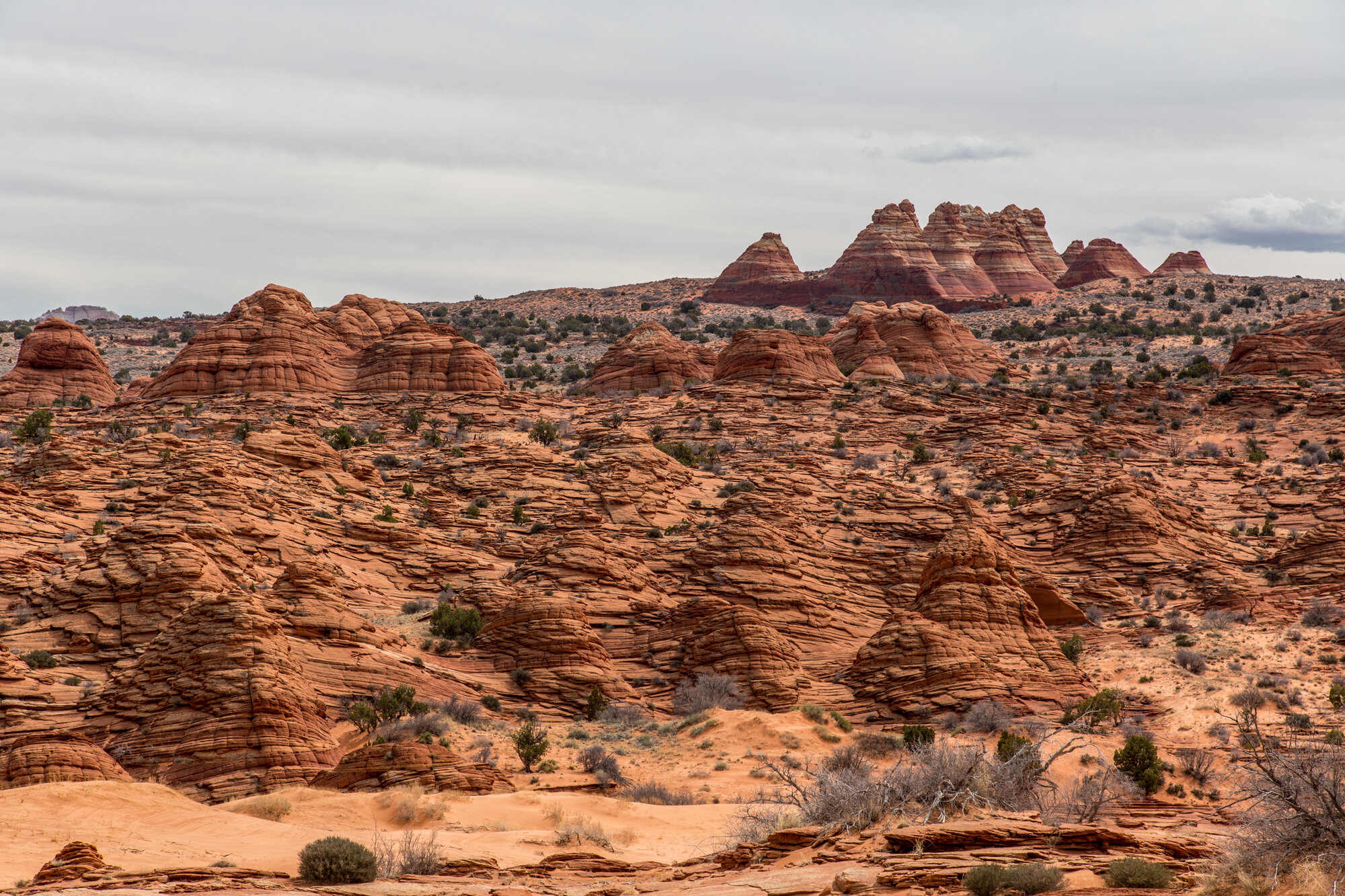
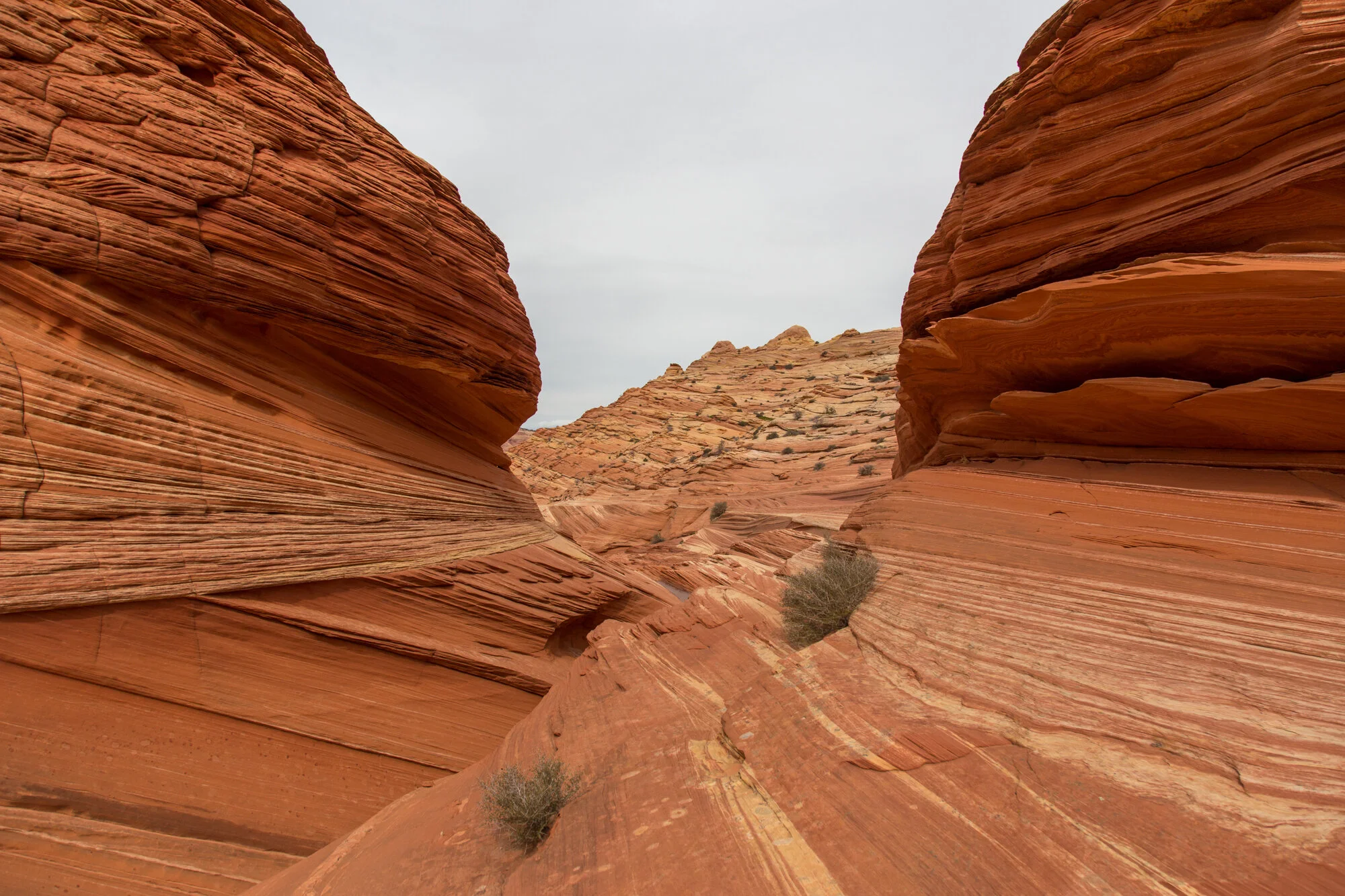
We set out on the journey with the first 15 minutes or so down an open wash. We then had a sandy climb up a hill for another 15 minutes or so in the hot sun but once on top we could see what was ahead. Once we descended the other side, we had to cross another wash before finding a route over a pretty rocky mountain. Coming out the other side was like landing on another planet. Although I have hiked many places, the landscape was very different and more dramatic than most places I have been. There were super interesting rock formations and miles and miles of nothingness.
You are not given a map and there are no signs marking the trail so there is a bit of route-finding but that is part of the fun. We took our time, took lots of photos and enjoyed the hike. There was a lot of different terrain that we had to cross, from sandy washes to fine desert sand dunes to slick rock. After an hour or so, we came to our last big push - a climb up a sandy hill that would lead us right into the opening of the Wave. I chose to traverse the slick rock to the side as I despise walking in the sand with shoes on, especially up hill.
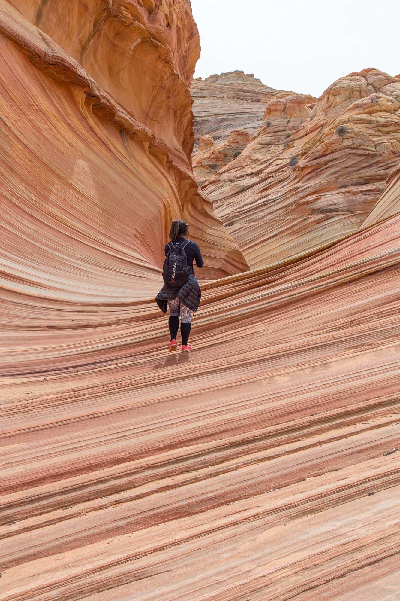
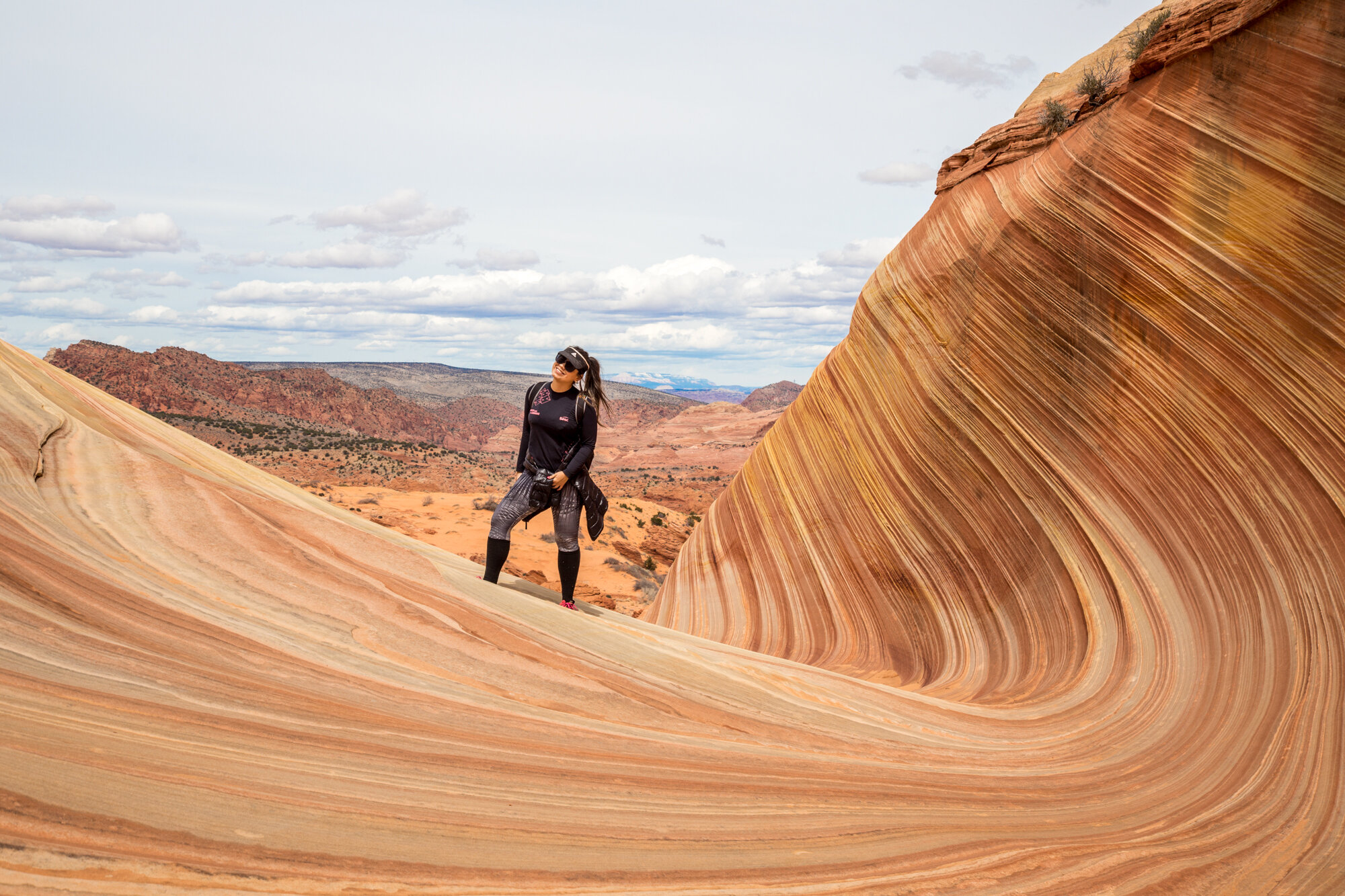
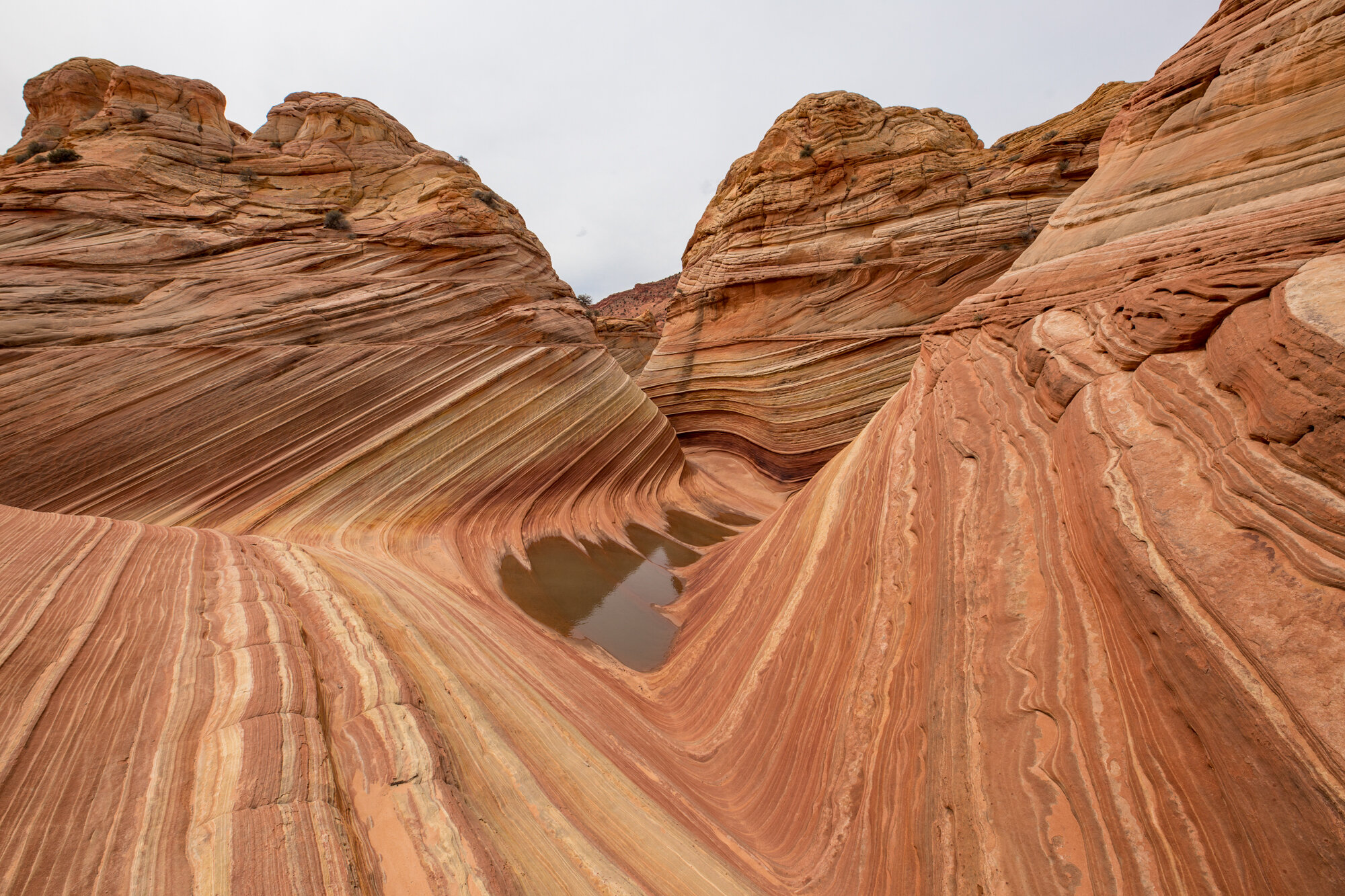
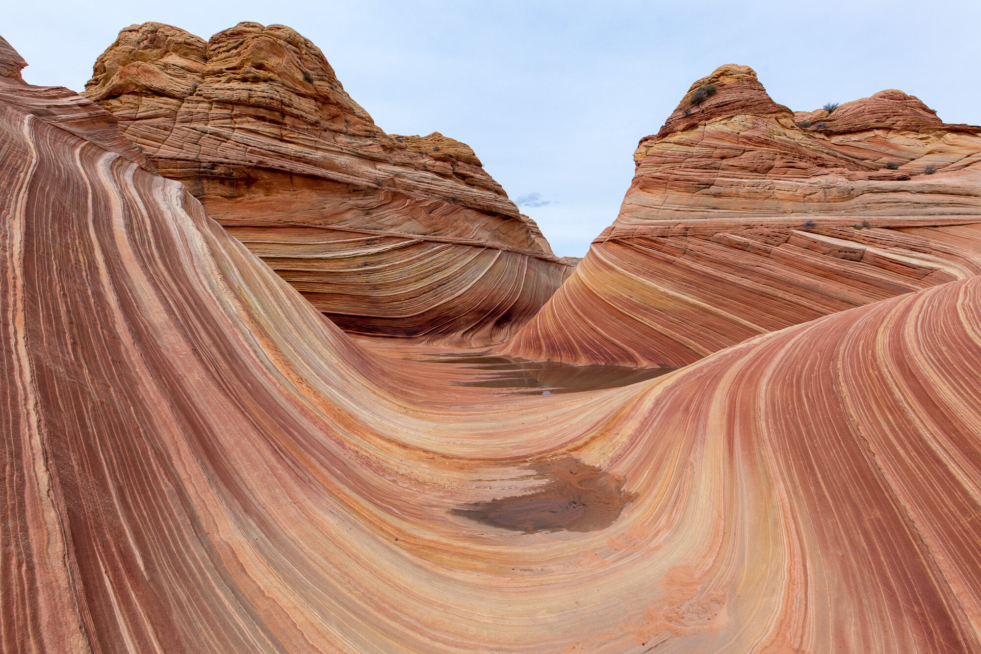
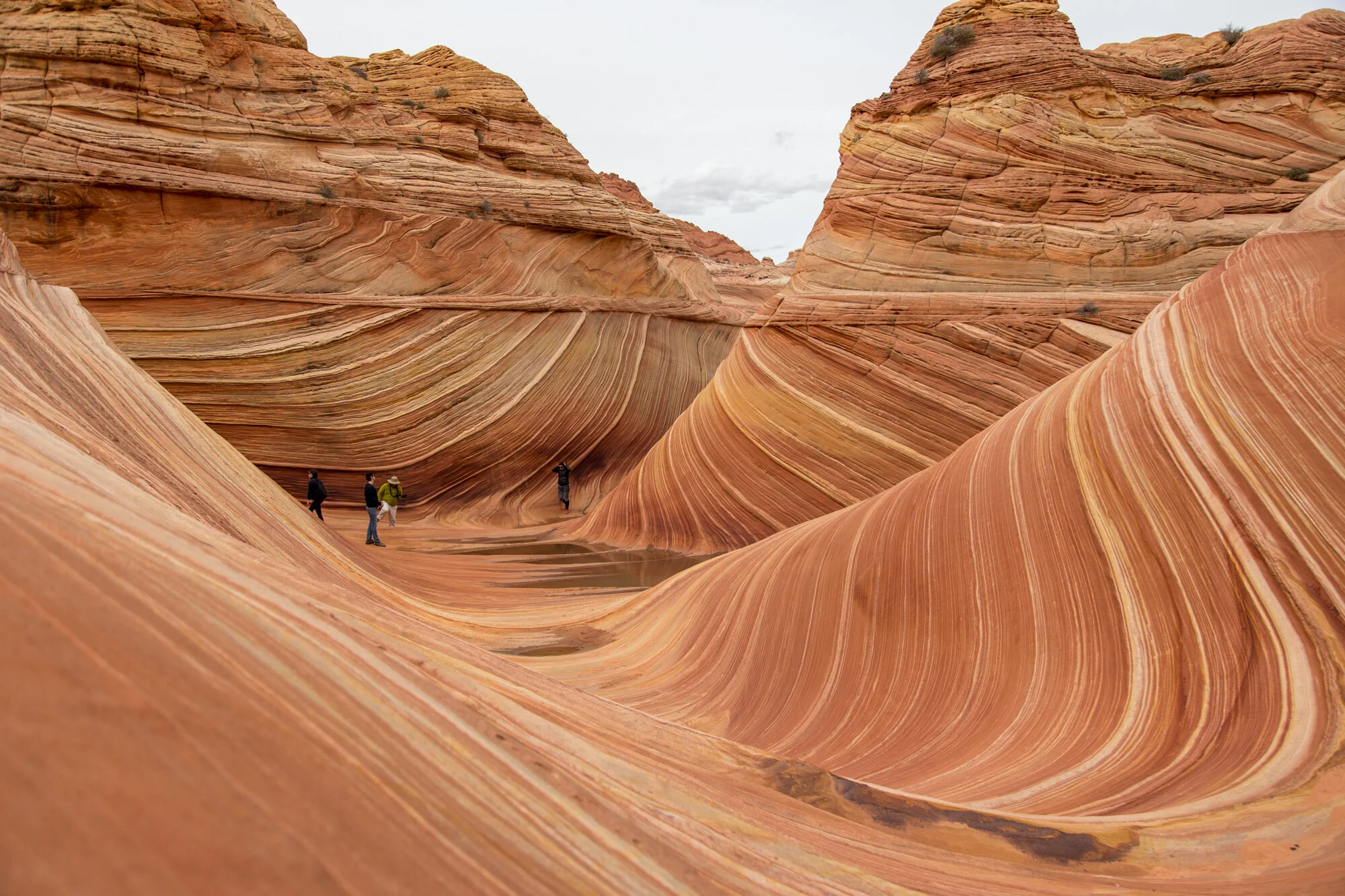
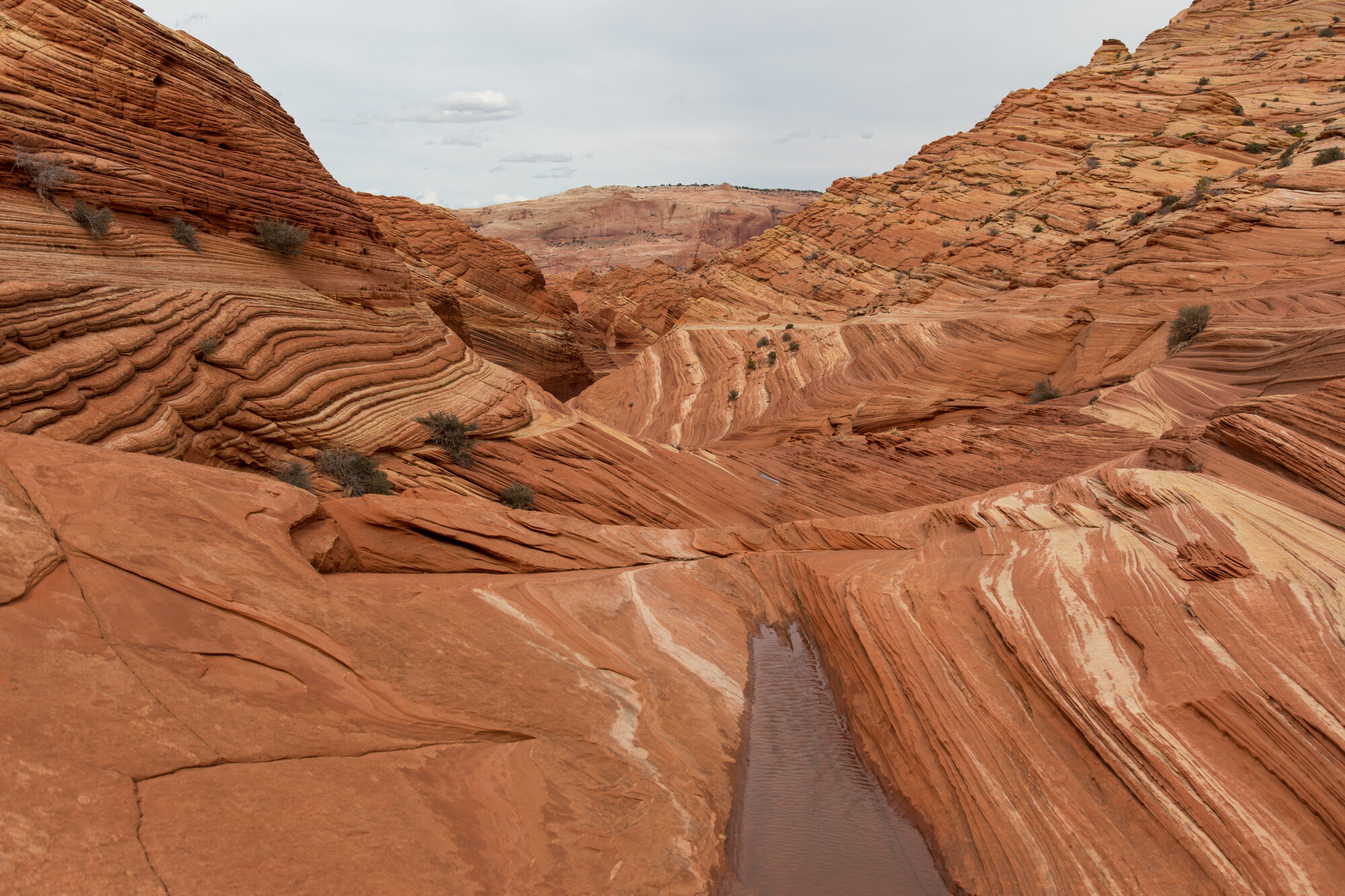
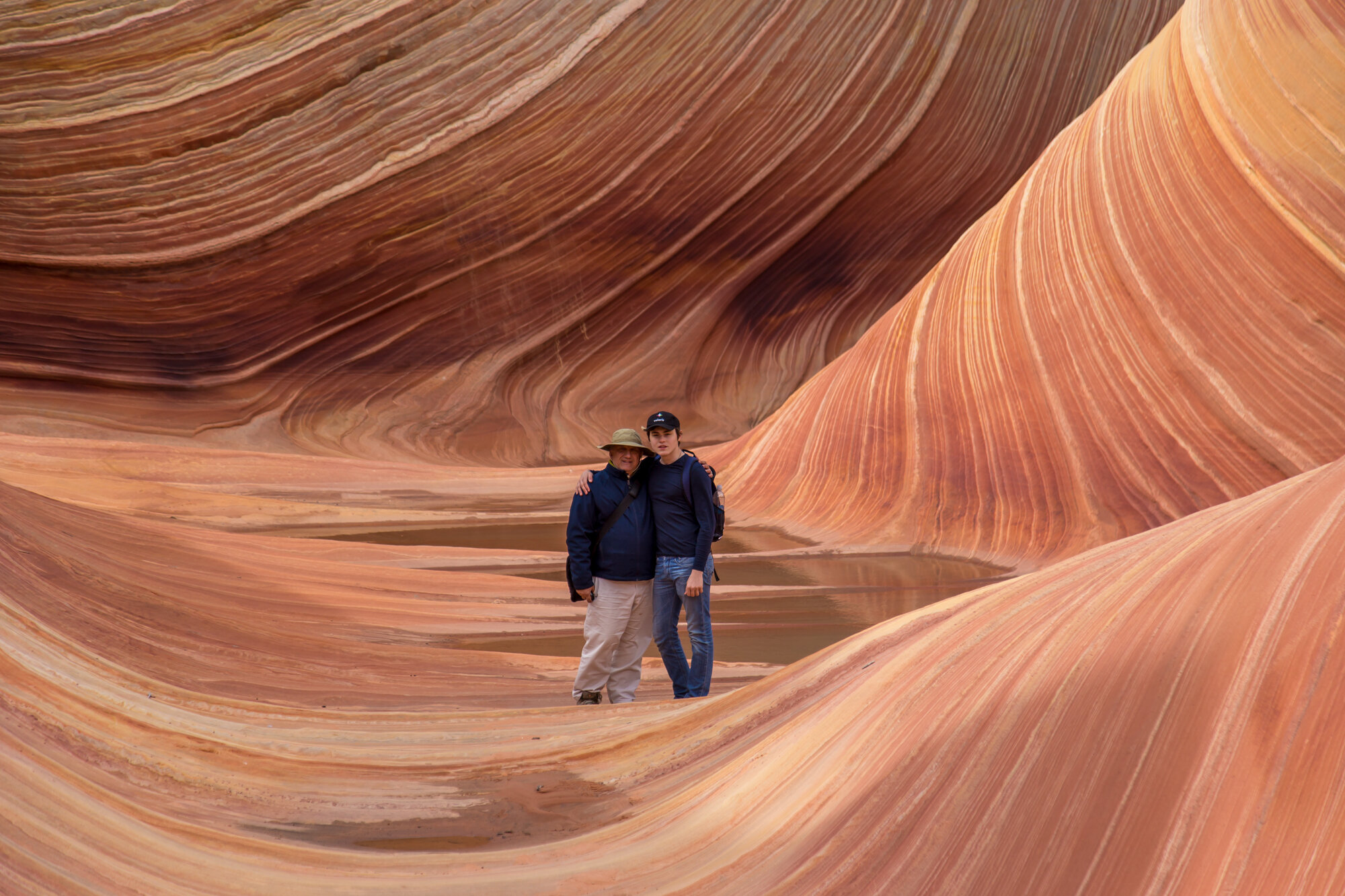
ARRIVING AT THE WAVE
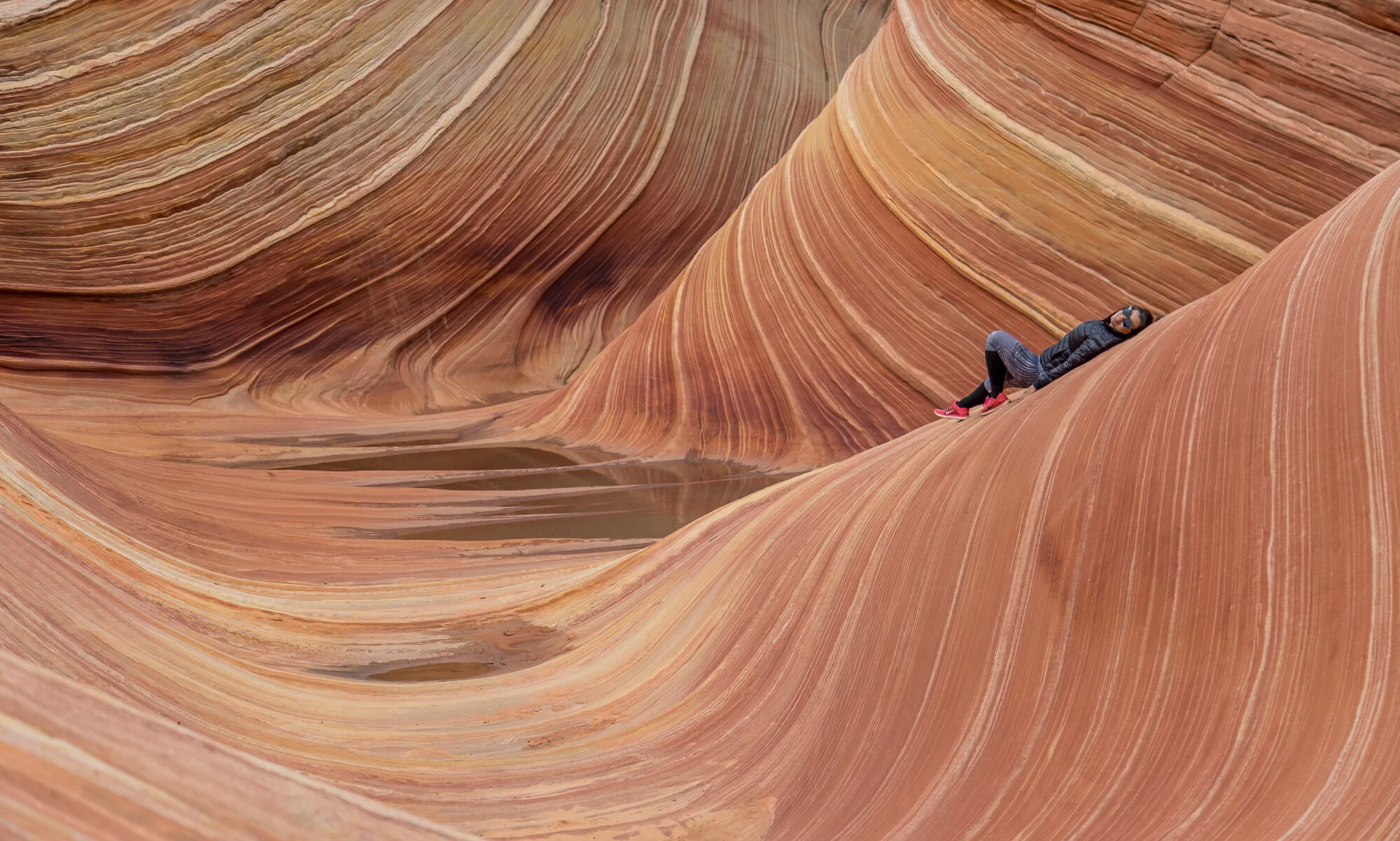
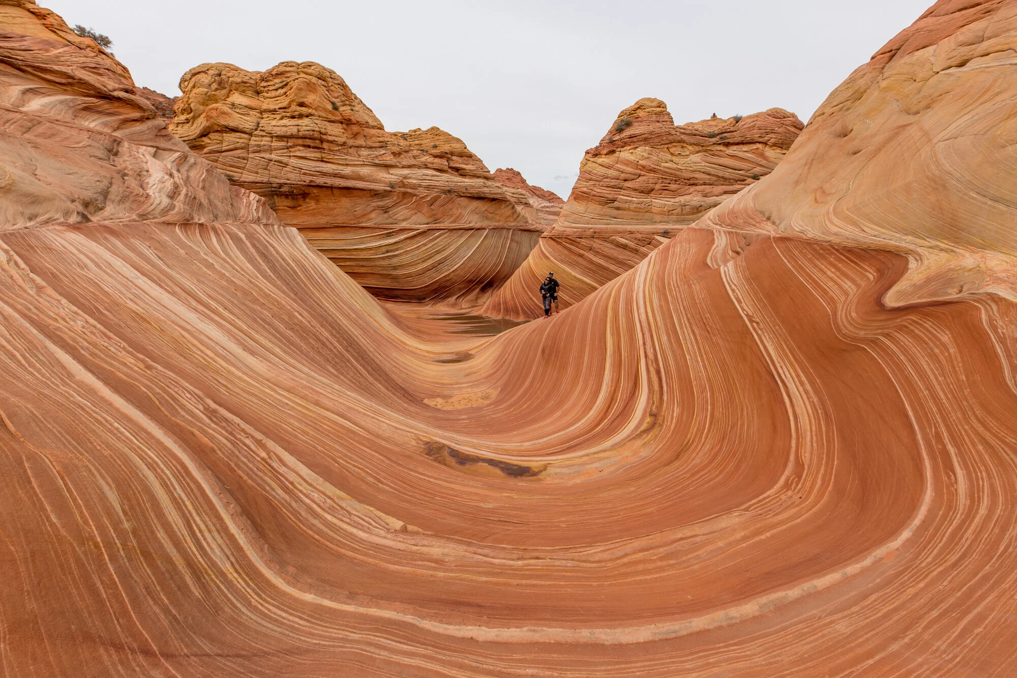
The entire trip had taken less than two hours and during that time we were all anticipating what we would see when we would arrive. Even climbing the sandy hill, the landscape didn't give us a clue to what it was hiding. As we made our way into the entrance, Marco picked a spot out to relax and soak up the sun. I decided to venture further into the rock formation to see what I could find. There was another group of three people that were there having lunch and taking photos. We joined them at the top of the rocks and had our lunch before taking lots of photos.
We had wondered on the hike in how they would patrol the area and make sure that only the people that had permits were at the Wave. While there, we realized that a BLM person makes the hike out here to ensure everyone's safety as well as makes sure that everyone has the proper permits. I have heard that the fine can be quite steep for getting caught without a permit.
EXPLORING PAST THE WAVE
I had done some research about the area around the Wave and found that there are lots of other things to explore. I wanted to see the second wave, the Big Mac rock and some of the arches (including Melody Arch). I knew that the group that I was with wouldn't be up for climbing Top Rock from the frontside so I looked at other routes. We went out exploring the surrounding area, stopping at the second wave first. It was not nearly as impressive as the Wave and the colors were really washed out in the mid-day sun. As the day wore on, the rest of the group decided that they weren't interested in continuing to explore and were ready to head back. We stopped at the Wave one final time before starting our return trip.
The next time I have the opportunity to hike the Wave, I will start the hike much earlier in the day so that I have the opportunity to further explore some of the surrounding areas.
Tips for Hiking the Wave
Leave early in the day so that you have time to explore the surrounding areas.
Make sure that you have a capable vehicle to make it down House Rock Valley Road.
Download the offline Google Maps of the area before you go because the actual spot for the Wave is marked on there. You can use this as a guide to stay on the trail.
Wear layers so that you take off or put on as the weather changes.
Make sure to have your permit!
Take a look at some of the other suggestions for things to do while in Page, AZ.